
Cionn Bheatha [Kinnaveagh]
Good walks are even better shared.
Overview
Cionn Bheatha [Kinnaveagh]
Nestled in Northern Ireland's Antrim Mountains, Cionn Bheatha, or Kinnaveagh, rises gracefully to an elevation of 546 meters. This Marilyn provides not only a satisfying ascent for hikers but also an array of stunning views at its summit.
Geology
The mountain presents a remarkable geology dominated by limestone and basalt, resulting in impressive cliffs and interesting karst formations. Hiking here feels like stepping onto a natural history museum, with every rock displaying tales of erosion and ancient landscapes.
Routes
For a rewarding experience, the Cionn Bheatha Circuit is highly recommended. This moderate trail spans about 8.5 km and should take approximately 3.5 hours to conquer. Expect to meander through vibrant grasslands and navigate some rocky passages, keeping your eyes peeled for those cheeky sheep who think they own the place.
Summit Features
The summit is marked by a robust cairn and a prominent trig point, both excellent spots to snap a selfie or enjoy a picnic. Just don’t let the views distract you from your lunch!
Terrain Type
Be prepared for a mix of terrain here; it can be rocky in places, and there's the occasional boggy section that can catch the unwary. Waterproof boots are recommended—trust me, soggy socks do not add to the hiking experience.
Views
From the top, you will revel in breathtaking views of Lough Neagh, the Antrim Plateau, and if the weather permits, the illustrious Mourne Mountains lurking on the horizon. For the best experience, spring and autumn are ideal—imagine a canvas of vibrant colours under a clear blue sky!
Hazards
Keep a weather eye on the sky and make sure to dress appropriately. Even though Cionn Bheatha is not the highest mountain, weather can change quicker than a politician's promise. Slippery rocks can turn an easy hike into an unexpected adventure, so make sure you're wearing suitable footwear.
Access
Nearest Parking: Located conveniently along the A26, there’s ample parking available.
Public Transport: The bus services from Belfast to Ballymena offer fairly frequent and reliable options, though a bit of a hike from the nearest bus stop is involved.
Nearest Town: Ballymena is the closest town—perfect for grabbing a bite or using the facilities before or after your adventure.
Facilities
No facilities exist on the mountain itself, but nearby Ballymena boasts several cafes and public toilets. Perfect for when you need to refuel or freshen up post-hike.
History
Cionn Bheatha, translating to 'the head of the life,' not only boasts natural beauty but a rich tapestry of folklore. Locals have spun tales of ancient kings and mythical battles linked to its rugged terrain, making it not just a hike but a journey through time.
So there you have it! Cionn Bheatha awaits your eager footsteps, offering both gratifying hikes and a smattering of local lore. Just remember, bring a camera, and don’t forget to enjoy the blissful quiet of the hills!
Explore routes near Cionn Bheatha [Kinnaveagh]
Public walks starting within 80 km of this hill. Nearby does not mean a route reaches the summit; check its map and access before setting out.
Derry~Londonderry City Walls Circuit
View route
Banagher Glen and Forest: complete higher-return circuit
View route
Route planning notes
These notes describe possible approaches, not verified navigable routes or permission to cross land. Check current paths, local access rules and conditions before setting out.
Cionn Bheatha Circuit
A scenic loop that offers a delightful mix of paths through lush grasslands and rocky outcrops, ideal for those looking to explore the surrounding area.
Make a day of it, together
Find someone to share the walk with, or organise a day out along a route you like.
Hill facts and local notes
Classifications
Elevation
384m
1,260 ft
Prominence
106m
Coordinates
55.0140, -7.9789
C014185
OS Map
06
At the Summit
The summit features a substantial cairn and a trig point, offering the perfect spot to catch your breath while reveling in the panoramic views.
Terrain & Geology
The mountain is predominantly composed of limestone and basalt, which create stunning cliffs and rocky outcrops. The weathered rocks give rise to unique karst features, contributing to its geological significance.
Views & Scenery
From the summit, you can spot the glistening waters of Lough Neagh, the rolling hills of the Antrim Plateau, and on a clear day, even the Mourne Mountains in the distance.
History & Heritage
Name Origin
The name 'Cionn Bheatha' translates roughly as 'the head of the life' in Irish, suggesting a place of vitality.
Historical Significance
Cionn Bheatha has been a notable feature in local folklore, often associated with stories of ancient kings and their battles.
Getting There & Facilities
Check current local access restrictions, parking rules and transport timetables before travelling. These notes do not confirm public access to the summit.
Parking
The nearest parking area is at the foot of the hill along the A26, with ample space for vehicles.
Public Transport
Buses from Belfast to Ballymena frequently serve the area; a bit of a walk from the nearest stop will get you moving.
Nearby Facilities
While there are no facilities directly on the mountain, nearby Ballymena has cafes, restaurants, and public toilets to refresh after a good hike.
Safety Information
Known Hazards
- Beware of sudden weather changes, and the rocky terrain can be slippery after rain. Always check the forecast and bring sturdy footwear!
General Safety Tips
- Check weather conditions before setting out
- Carry appropriate clothing and equipment
- Let someone know your planned route
- Take a map, compass, and GPS device
- Carry emergency supplies: food, water, first aid kit, torch
Hills
Some common questions about the hills answered
Are there group walks up Cionn Bheatha [Kinnaveagh]?
Many walkers use Walkmates to join or organise walks with others. You can check for group walks around Cionn Bheatha [Kinnaveagh] through the maps
Are there other walkers around Cionn Bheatha [Kinnaveagh]?
Activity varies by location and time, but Walkmates lets you see whether others have shared walks or shown interest in this area. Find other people through the walking friends search walking friends for Cionn Bheatha [Kinnaveagh] search or of course create your own walk for Cionn Bheatha [Kinnaveagh]
Can I organise a walk to Cionn Bheatha [Kinnaveagh]?
Yes. If there aren’t any walks listed already, you can create a walk and make it available for others to join.
If you're signed up to Walkmates, you can create a walk to Cionn Bheatha [Kinnaveagh].
How do I find a walk up this hill?
There are often multiple ways to walk this hill, depending on experience and route preference. Walkmates helps you explore walks and routes that others have shared.
Can I suggest a new route up Cionn Bheatha [Kinnaveagh]?
Yes. You can suggest or create routes to share with others. Walkmates focuses on the social side of walking, so routes are used to help people organise walks and explore areas together, rather than as detailed navigation tools or route libraries.
Other uses really appreciate knowledgeable walkers sharing their routes. Share your favourite route to Cionn Bheatha [Kinnaveagh] here
The is an error or something incorrect about this hill. How do I let you know?
We always strive to keep the information on Walkmates as accurate as possible. If you find an error, please let us know through the contact form and we'll aim to correct it as quickly as possible
Community Discussion
Comments
Location
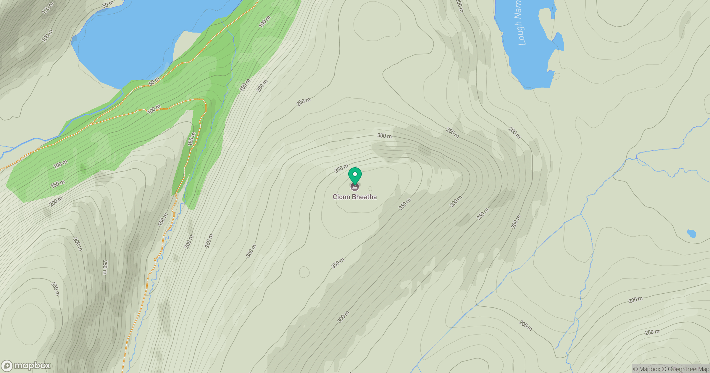
Grid reference: C014185
View on OpenStreetMapOpens a map in a new tab, centred on the hill.
Hills within 30 km
Straight-line distance, not a walking route or confirmation of access.
No comments yet. Be the first.